Grower Photos and Comments About Row Covers and Sprinkling (5:30pm, Wed., March 7, 2018)
go.ncsu.edu/readext?514827
en Español / em Português
El inglés es el idioma de control de esta página. En la medida en que haya algún conflicto entre la traducción al inglés y la traducción, el inglés prevalece.
Al hacer clic en el enlace de traducción se activa un servicio de traducción gratuito para convertir la página al español. Al igual que con cualquier traducción por Internet, la conversión no es sensible al contexto y puede que no traduzca el texto en su significado original. NC State Extension no garantiza la exactitud del texto traducido. Por favor, tenga en cuenta que algunas aplicaciones y/o servicios pueden no funcionar como se espera cuando se traducen.
Português
Inglês é o idioma de controle desta página. Na medida que haja algum conflito entre o texto original em Inglês e a tradução, o Inglês prevalece.
Ao clicar no link de tradução, um serviço gratuito de tradução será ativado para converter a página para o Português. Como em qualquer tradução pela internet, a conversão não é sensivel ao contexto e pode não ocorrer a tradução para o significado orginal. O serviço de Extensão da Carolina do Norte (NC State Extension) não garante a exatidão do texto traduzido. Por favor, observe que algumas funções ou serviços podem não funcionar como esperado após a tradução.
English
English is the controlling language of this page. To the extent there is any conflict between the English text and the translation, English controls.
Clicking on the translation link activates a free translation service to convert the page to Spanish. As with any Internet translation, the conversion is not context-sensitive and may not translate the text to its original meaning. NC State Extension does not guarantee the accuracy of the translated text. Please note that some applications and/or services may not function as expected when translated.
Collapse ▲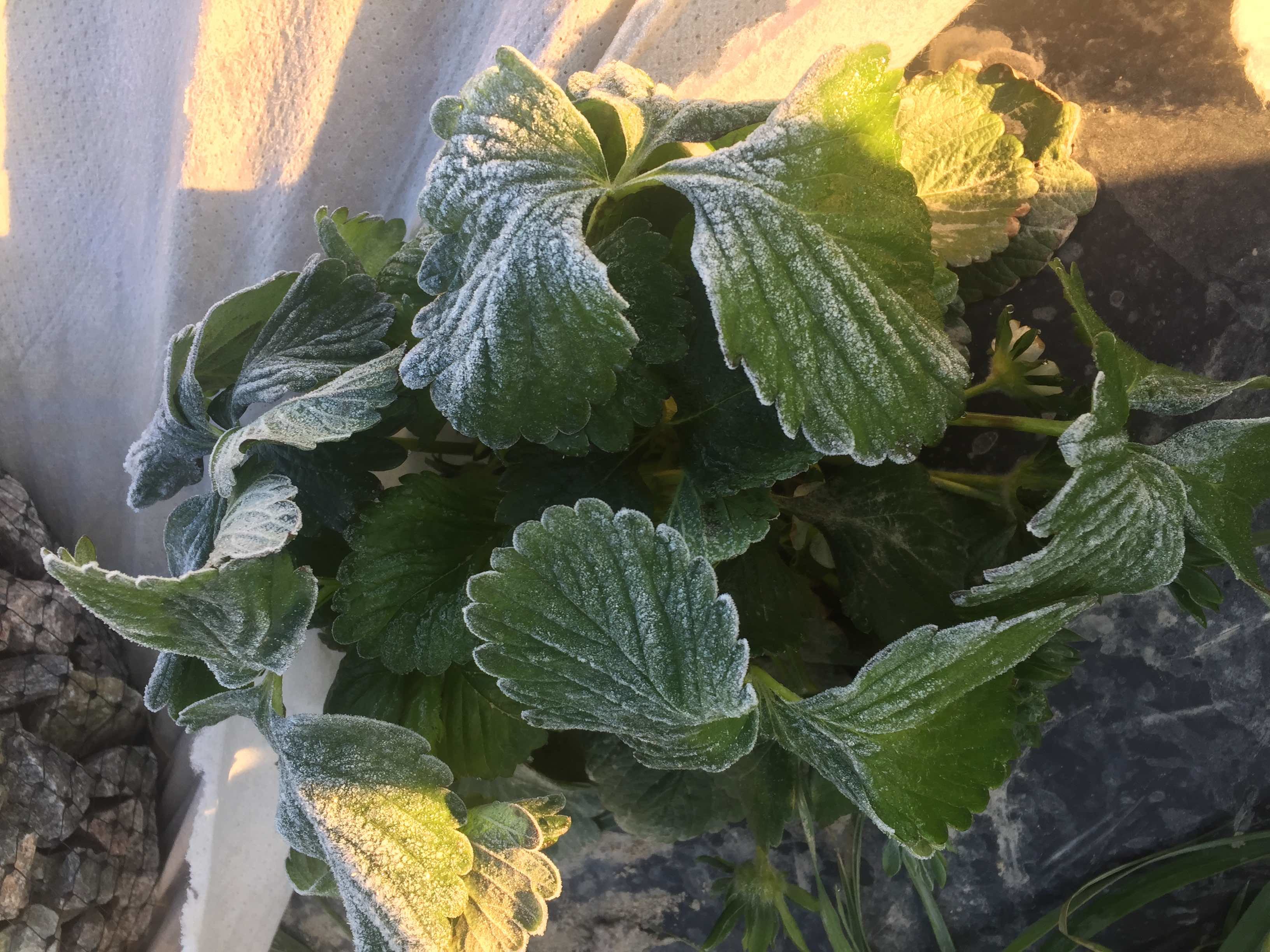 Fig. 1. Photo by John Gross, Sanford, NC – taken on Monday morning, March 5th. The Sanford area had a “pretty good frost” that morning. John had protected with row covers. However, in this one area he had a tear in the cover, and you could see a pretty heavy frost on the leaves of unprotected plants. The grower did suffer some frost losses in places where the row cover was in direct contact with blossoms beneath. At the bottom of this advisory you can see how Louisiana growers prevent blossom losses of this type by suspending the row covers with wire hoops. Louisiana growers use row covers differently from growers in NC, SC, and VA. They actually suspend them so that blossoms in contact with the cover don’t get killed. With a “good frost” it is possible to lose 5% or more of the blossoms that are in direct contact with the cover (see Figs. 4-5).
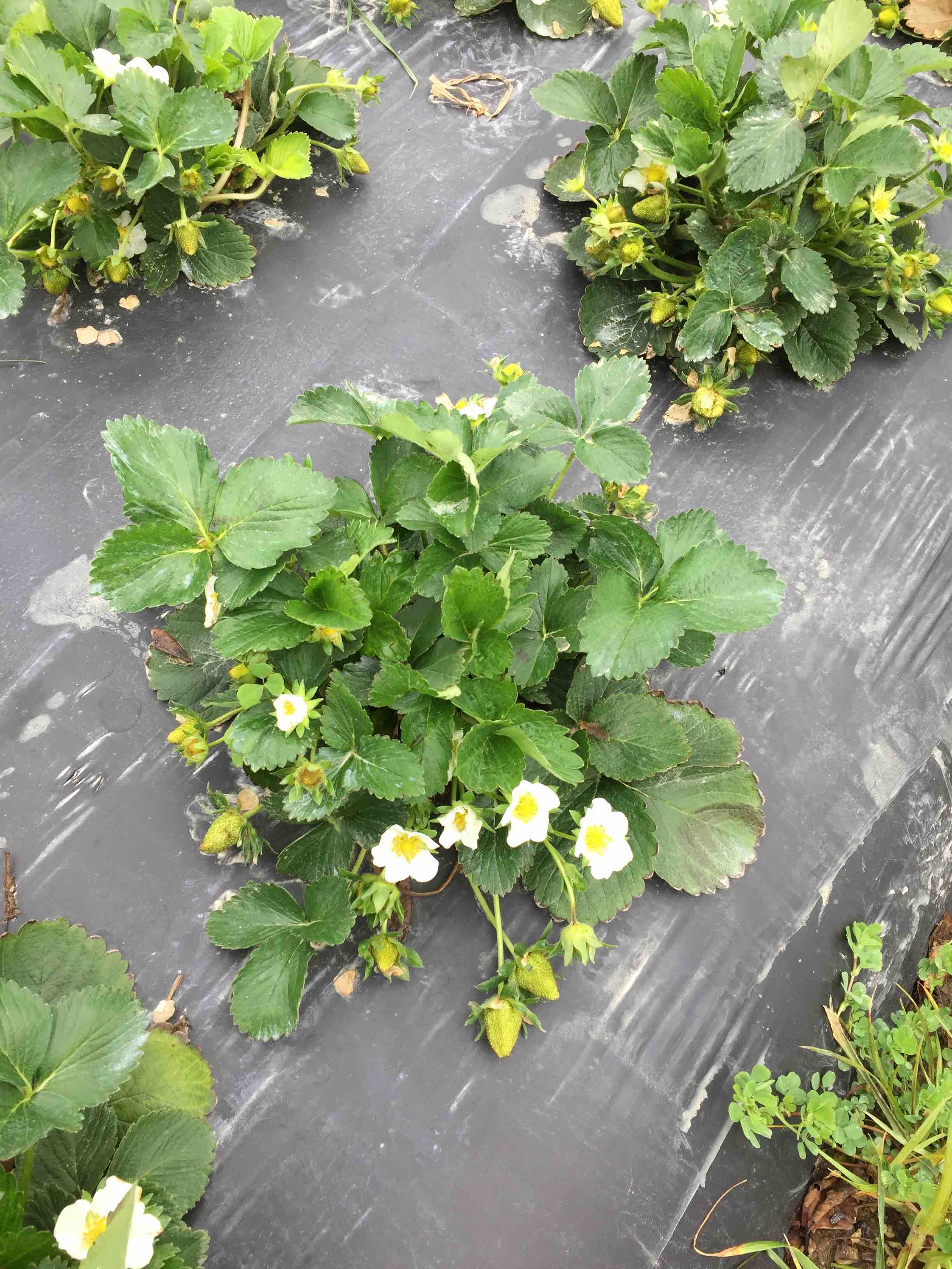 Fig. 2. John Gross, who took this photo of his Sweet Charlies today, said: “there is a lot of green fruit and 4-6 new blossoms.” Last week was when these Sweet Charlie plants were “covered up.” A week ago (Feb 28), these same Sweet Charlie plants had 10-15 open blooms. It looks like bloom has already peaked with this variety!
Frost returning
The row covers went back on today at about 4 p.m. – expecting a “big frost” in the morning in Sanford. Sanford 3.7.18 Detailed Forecast
The Sweet Charlie plants shown in Figure 1 had almost 2 full days this week without covers being on. They were rolled back Tuesday morning (after the frost), to “open things up” and allow better air movement for pollination and fruit set. The grower saw a “few” bees, but not many were flying with these cool daytime temperatures. The grower thought it might have been worth it (uncovering for 2 days), but if he did not have a sprinkling system, it would NOT have been a good idea to remove the covers in the early week, as it also rained yesterday and last night. And, once a cover gets soaked, it cannot be quickly re-deployed in the event of another frost! They must be handled dry!
Rains complicates matters with row covers, but this grower had sprinkling as back-up plan for tonight — in the event covers were too wet to re-apply
I know this particular Sanford grower was quite concerned he may not be able to get his covers back on if they became soaked by rains on Tuesday and Wednesday night. However, rainfall accumulations weren’t too heavy (< 4/10ths) and high winds today helped to dry covers out. Had he not been able to get covers back on, he has sprinkler irrigation as back-up.
Sprinkling on a night with high dewpoints
In case he had been forced to sprinkle for frost protection tonight, my guess he would have been starting around 1 a.m. (see Sanford 3.7.18 Detailed Forecast). With dewpoints this high (27-28 F) you can pretty much rely on starting the sprinkling when you see first sign of “ice crystals” forming on lay flat hose, or in the rolled up row covers.
Sprinkling on a night with low dewpoints – stick with the 33 F wet bulb rule
I am noticing that for Thursday night/Friday morning, temperatures will be colder (see state map in Fig. 3), and air may be much drier! Dewpoints on Friday morning will be down in the low 20s in Sanford, but take a look at other parts of the state like Greensboro Greensboro
Note that Greensboro could see a minimum of 27 F and dewpoint of only 14 F on Friday morning! A grower using irrigation for frost protection in that central piedmont area would need to plan on starting sprinkling at about 6 p.m.! That’s right! Note that at 1800 (6 p.m.) the wet bulb is down to 32 F, and sunset is 6:20 p.m. So, that temperature will be dropping like a rock. There is no question about it, a row cover would be a lot easier to use, and should also be very effective.
Because conditions are so variable across North Carolina, and throughout our whole region, everyone needs to be keeping a close eye on the forecast for their immediate area:
Virginia
10-DAY DETAILED HOURLY WEATHER FORECASTS
North Carolina
10-DAY DETAILED HOURLY WEATHER FORECASTS
South Carolina
10-DAY DETAILED HOURLY WEATHER FORECASTS
Georgia
10-DAY DETAILED HOURLY WEATHER FORECASTS
Parting shot of Camarosa taken today in SANFORD NC (about 3 new blooms)
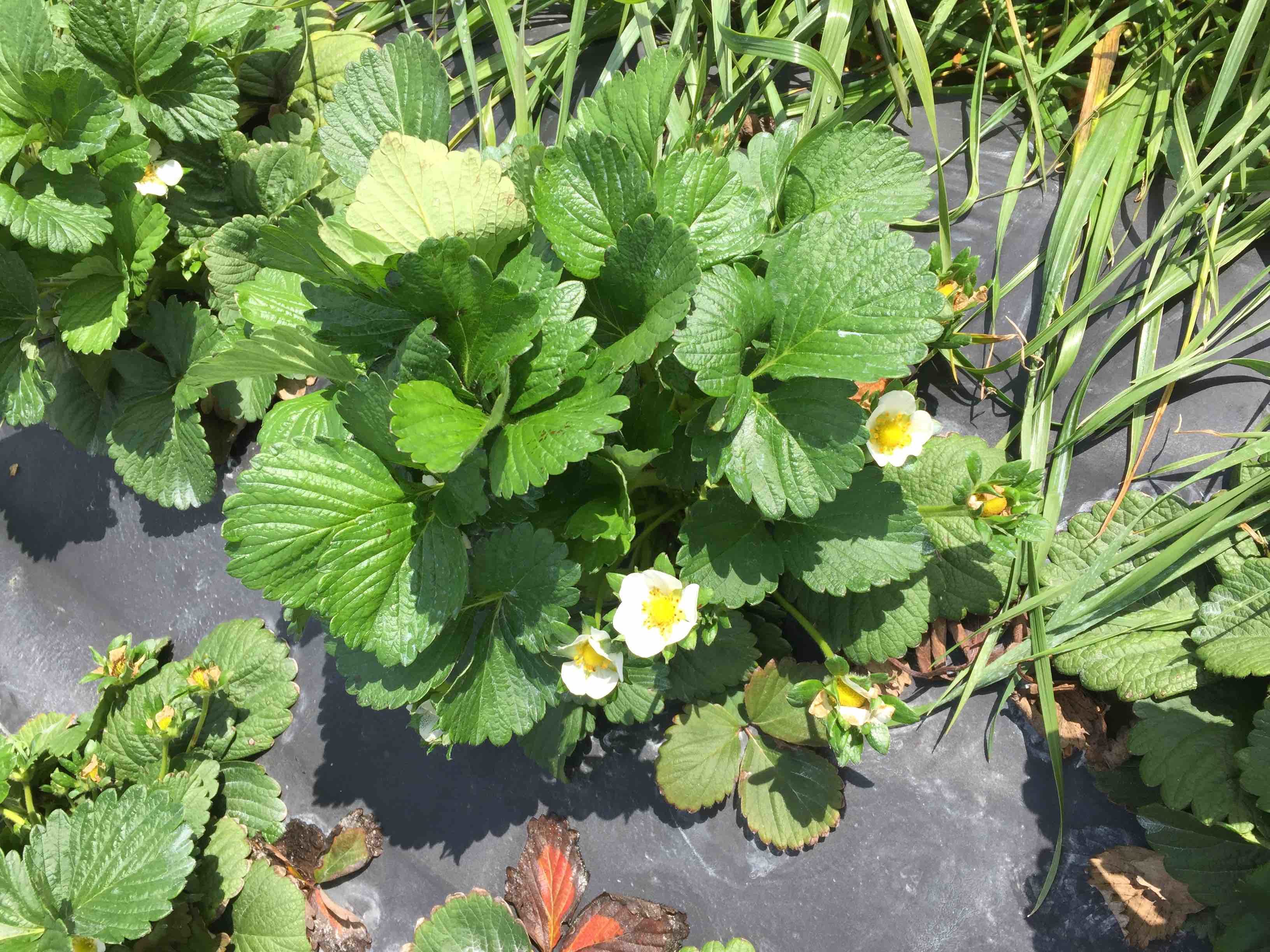 Fig. 3. Camarosa in Sanford today
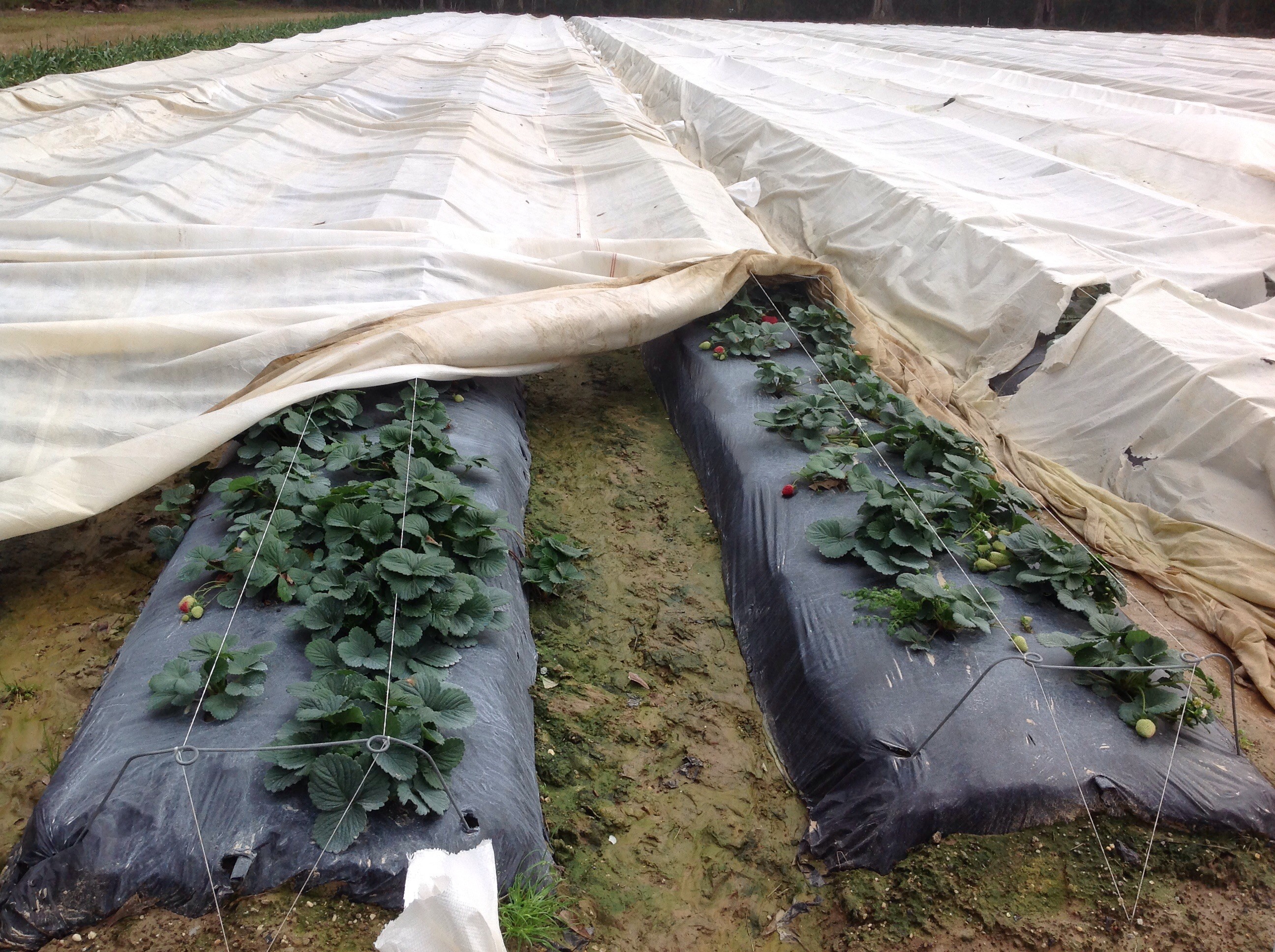 Fig. 4.Row covers are suspended and not allowed to float on top of strawberry plants in Louisiana’s Tangipahoa Parish.
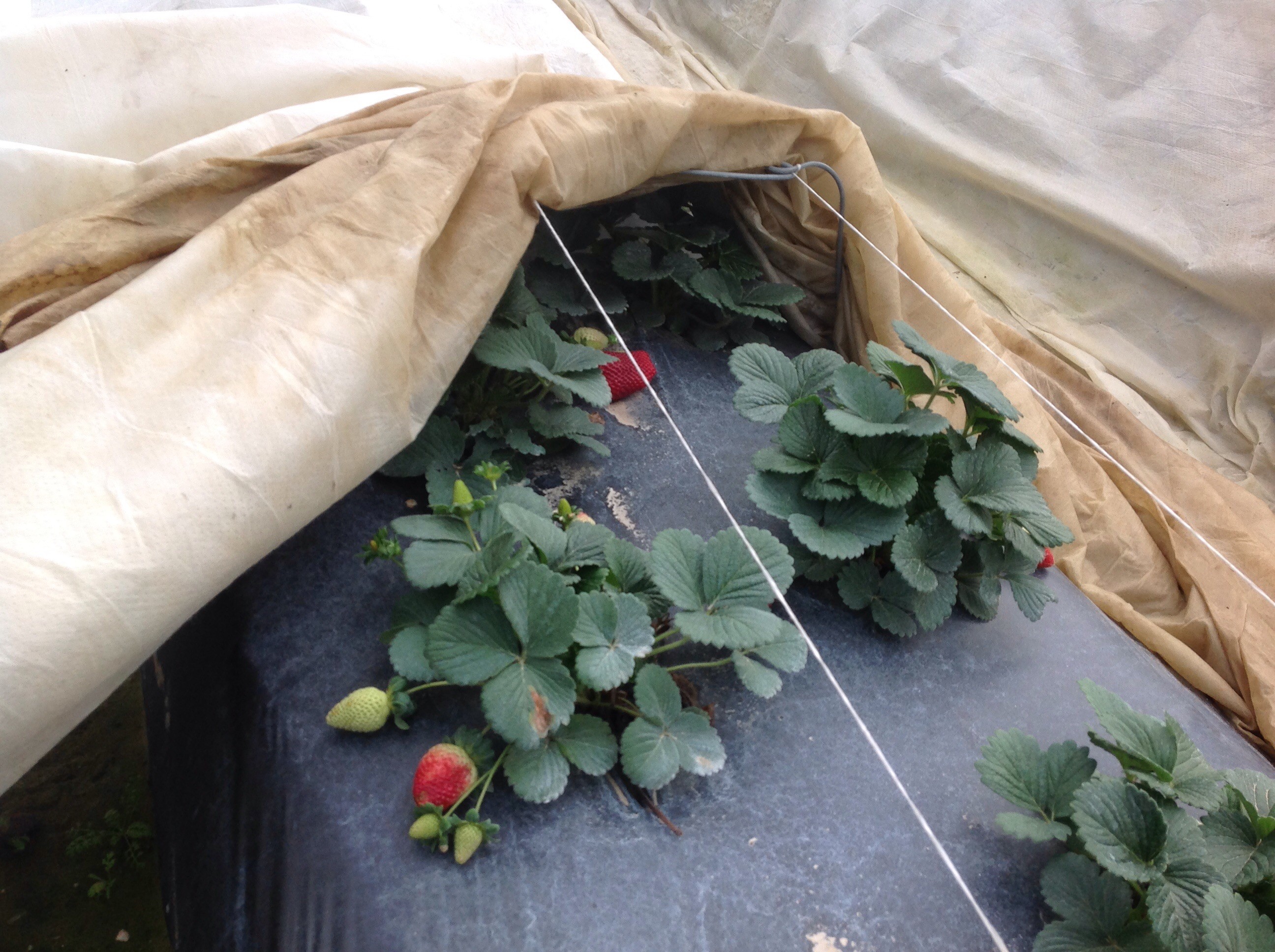 Fig. 5. The row cover you see in the photo can be pulled back over the crop to protect blooms from a possible frost event during picking season.


