AWIS Winter Weather Advisory: Rain, Followed by Freezing Temperatures
go.ncsu.edu/readext?904762
en Español / em Português
El inglés es el idioma de control de esta página. En la medida en que haya algún conflicto entre la traducción al inglés y la traducción, el inglés prevalece.
Al hacer clic en el enlace de traducción se activa un servicio de traducción gratuito para convertir la página al español. Al igual que con cualquier traducción por Internet, la conversión no es sensible al contexto y puede que no traduzca el texto en su significado original. NC State Extension no garantiza la exactitud del texto traducido. Por favor, tenga en cuenta que algunas aplicaciones y/o servicios pueden no funcionar como se espera cuando se traducen.
Português
Inglês é o idioma de controle desta página. Na medida que haja algum conflito entre o texto original em Inglês e a tradução, o Inglês prevalece.
Ao clicar no link de tradução, um serviço gratuito de tradução será ativado para converter a página para o Português. Como em qualquer tradução pela internet, a conversão não é sensivel ao contexto e pode não ocorrer a tradução para o significado orginal. O serviço de Extensão da Carolina do Norte (NC State Extension) não garante a exatidão do texto traduzido. Por favor, observe que algumas funções ou serviços podem não funcionar como esperado após a tradução.
English
English is the controlling language of this page. To the extent there is any conflict between the English text and the translation, English controls.
Clicking on the translation link activates a free translation service to convert the page to Spanish. As with any Internet translation, the conversion is not context-sensitive and may not translate the text to its original meaning. NC State Extension does not guarantee the accuracy of the translated text. Please note that some applications and/or services may not function as expected when translated.
Collapse ▲Rain next week, and freeze around christmas
in collaboration with AWIS Weather Services
Dear all,
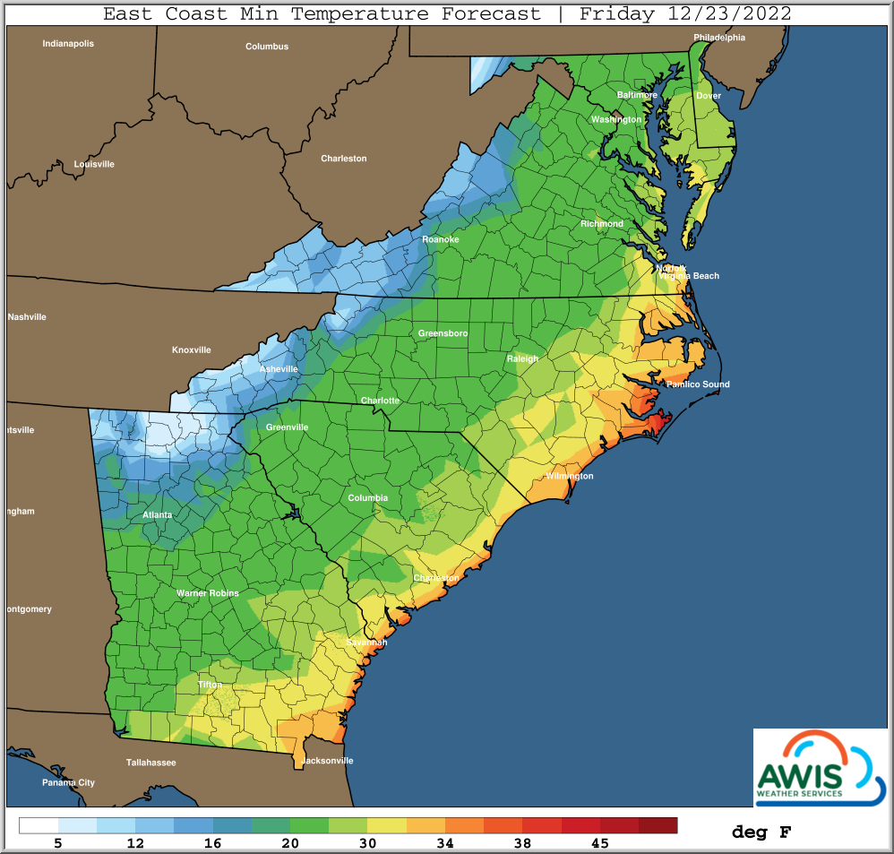
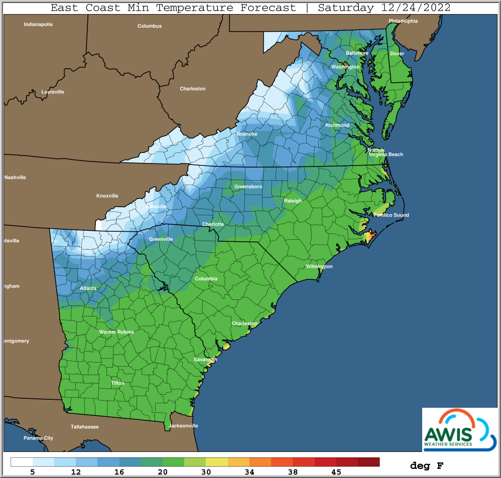
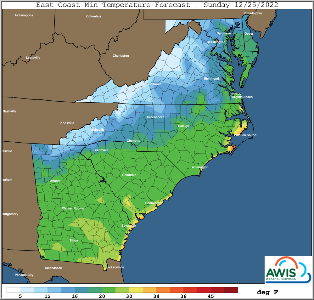
Most of central and western NC as well as most of the mid-Atlantic will experience minimum temperatures in the teens or even single digits (higher elevations) at the end of the coming week, right around Christmas Eve (Figure 1). Rainfall is expected in most of the area, beginning on Tuesday (12/20) all the way to Thursday (12/23).
Figure 1: Predicted minimum temperatures for the region for 12/23, 12/24 and 12/25 2022.
Why protect?
First, it is important to understand why you want to protect your plants at this time of the year. The most valuable part that you want to protect is the crown: freezing temperatures can cause non reversible damage to a strawberry crown. This will lead to low yields or even dead plants in the worst case scenario.
Fully dormant strawberry plants usually don’t show crown damage until temperatures at crown level reach drop below the teens. Generally, if you are in an area in which the predicted min. temperature doesn’t fall below 20F, AND your plants are hardened off and dormant, there will be no need to cover the plants.
There is not a ‘one fits all’ approach.
However, I can’t stress enough that this is not true for plants that did not had enough hardening time and are still active. This might be the case in some areas in Eastern SC, Southern GA and Coastal NC. If that is the case, we recommend to protect those plants, even if the min temperatures are predicted to be in the low 20s.
In many areas in Central and Western NC, Western GA, North Western SC, most of VA and the mid-Atlantic, min temperatures are predicted to be in the teens or even single digits. There are reports of fully dormant ‘Chandler’ that did withstand low teens without damage. However, with freezing temperatures approaching early in the season, at this point of time we highly recommend to use floating row covers to protect your crop from those temperatures.
The situation becomes more difficult because rain is predicted from 12/20 to 12/23 for most of the region, and temperatures are predicted to drop fast after the rain. That does not leave a lot of time to deploy row-covers between rain and the predicted low temperatures. In most cases, it would be advisable to protect your crop with row-covers before the rain: coming Sunday (12/18), Monday (12/19) or Tuesday (12/20).
Be prepared that even with row cover protection, especially your canopy can still suffer cold damage, depending on the condition of the cover and the experienced minimum temperatures.
We will be monitoring the situation closely and will follow up with updated before Christmas.
As always, I hope this helps,
Mark


