AWIS Weather Advisory: Act Now: Rain on Saturday, Followed by a Very Cold Night!
go.ncsu.edu/readext?843264
en Español / em Português
El inglés es el idioma de control de esta página. En la medida en que haya algún conflicto entre la traducción al inglés y la traducción, el inglés prevalece.
Al hacer clic en el enlace de traducción se activa un servicio de traducción gratuito para convertir la página al español. Al igual que con cualquier traducción por Internet, la conversión no es sensible al contexto y puede que no traduzca el texto en su significado original. NC State Extension no garantiza la exactitud del texto traducido. Por favor, tenga en cuenta que algunas aplicaciones y/o servicios pueden no funcionar como se espera cuando se traducen.
Português
Inglês é o idioma de controle desta página. Na medida que haja algum conflito entre o texto original em Inglês e a tradução, o Inglês prevalece.
Ao clicar no link de tradução, um serviço gratuito de tradução será ativado para converter a página para o Português. Como em qualquer tradução pela internet, a conversão não é sensivel ao contexto e pode não ocorrer a tradução para o significado orginal. O serviço de Extensão da Carolina do Norte (NC State Extension) não garante a exatidão do texto traduzido. Por favor, observe que algumas funções ou serviços podem não funcionar como esperado após a tradução.
English
English is the controlling language of this page. To the extent there is any conflict between the English text and the translation, English controls.
Clicking on the translation link activates a free translation service to convert the page to Spanish. As with any Internet translation, the conversion is not context-sensitive and may not translate the text to its original meaning. NC State Extension does not guarantee the accuracy of the translated text. Please note that some applications and/or services may not function as expected when translated.
Collapse ▲Some areas might need to deploy covers today to cold protect on Sunday morning.
In collaboration with AWIS Weather Services.
Dear all,
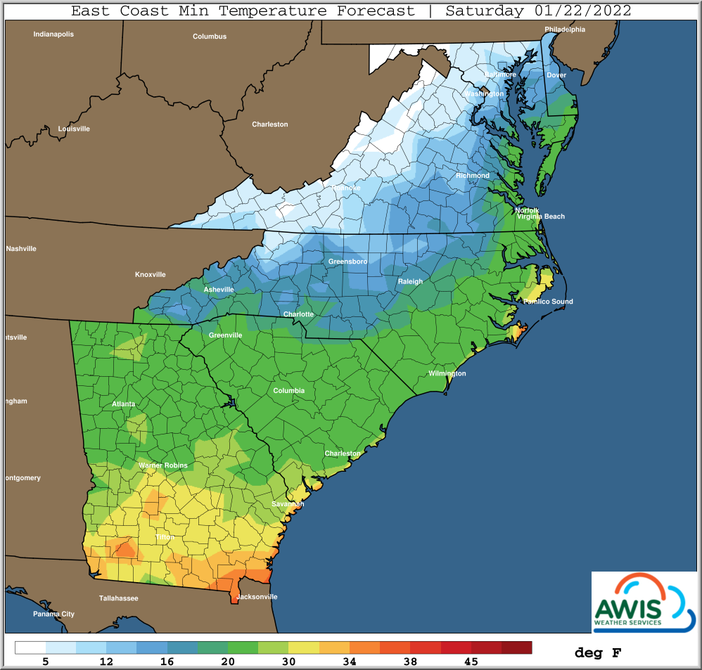
The few hours of warmer temperatures today and tomorrow do not justify to take of your covers. Snow in the West/North and rain in the East will fall later today and tomorrow, followed by a temperature drop into the teens for most of North Carolina, Virginia and further North. Temperatures in the teens are certainly in the range that can cause damage to strawberry crowns.
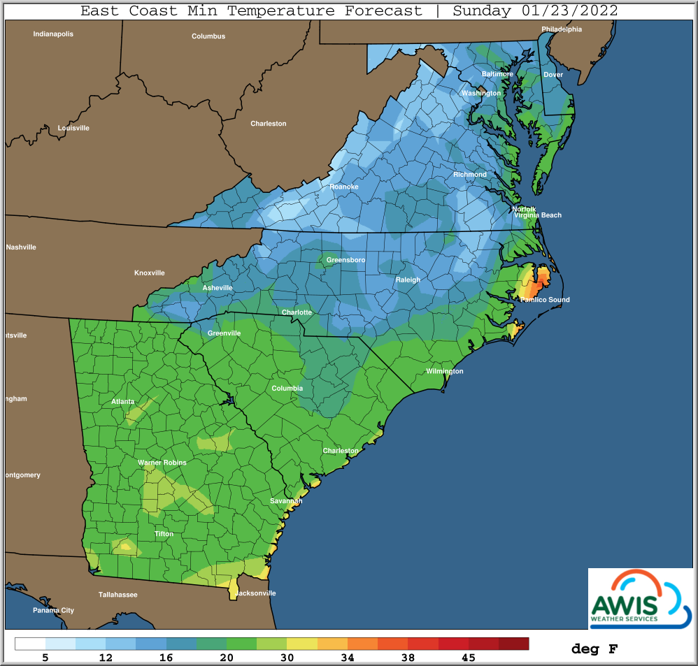
Please monitor the predicted minimum temperatures in your location closely today, especially for the night of Saturday (1/22) to Sunday (1/23).
If your predicted minimum temperatures are in the teens, we recommend to deploy row covers today, before rain or snow will weigh them down. The incoming rain and snow later today and on Friday (1/21) will make it hard to move row covers. Do it before.
For those who already have deployed their covers (mostly in western NC): Don’t take them off yet.
General Weather Discussion:
*** More Wintry Precip today and tomorrow (Friday)
*** Colder Again Friday/Saturday
*** Hard Freeze Saturday Morning, Perhaps 10-15 Northern Areas
*** Some Potential Near 10 Degrees Northern / Inland Cold Pockets Saturday
*** Precip Late Weekend, Perhaps Wintry Central/Eastern Carolinas
*** Very Cold Potential Again Middle-End Next Week
*** Perhaps A Break In Recent Cold Onslaughts By Early February
Next system will spread some rain and wintry precip parts of
the Eastern Mid-Atlantic and parts of Central/Eastern Carolinas, starting today and ending Friday.
Some areas of the Eastern Carolinas and SE VA that had mostly
heavy rains Sunday, may get some wintry weather with this round.
Colder again behind this, with potential for hard freezes again,
particularly Saturday and Sunday morning when winds are the lightest.
The depth and strength of this high pressure area has potential
to result in slightly colder temperatures than have already
occurred, particularly North Carolina Northward. This could put
minimums closer to 10-15 ranges, with outside shot of few
coldest pockets into the upper end of single digits. Close
enough to be aware of, given anticipated dew point temperatures
getting to 10 degrees and a little below.
Yet another fast moving system in the Southern Jet Stream could
spread some wintry precip even further South across the Central
and Eastern Carolinas later this weekend.
More cold weather in store for the middle and end of next week!
Weather set up continues to favor cold arctic air masses invading
the USA from Canada through late January. Timing of these and
how far South the coldest air gets is very dependent on potential
of the development of Southern Stream Storm Systems.
Temperature Predictions:
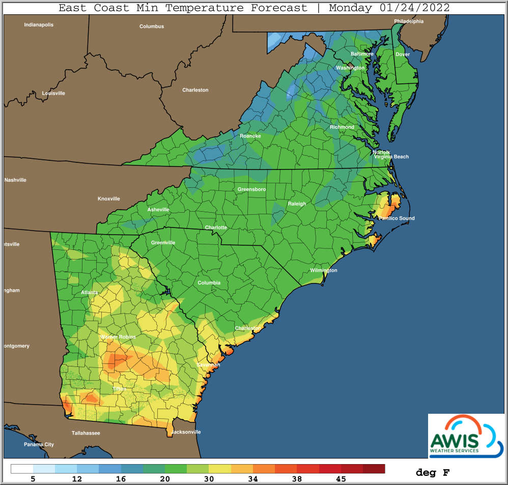
Figure 1: Minimum Temperatures in the Region: If you are in a region that will experience minimum temperatures below 20F in Saturday or Sunday, we recommend to protect your strawberry plants with rowcovers. You should deploy those covers today (1/20), before the incoming rain.
Recommendations:
The rain later today and on Friday, with the temperature drop directly following even in Eastern NC makes this a very dangerous weather situation for your crop. YOU NEED TO MONITOR THE PREDICTED MINIMUM TEMPERATURES for Saturday and Sunday TODAY!
If those temperatures are below 20F, we highly recommend to put row covers over your field TODAY (1/21), to protect your crop from potential crown damage due to the low temperatures.
Better safe than sorry. The predicted weather situation definitely warrants caution and action in many areas in NC that were not affected by the previous snow storm and the cold weather.
As always I hope that helps,
Mark


