30 Day Ag Weather Outlook MD – VA – TN- NC – SC (2pm, Sunday, May 14, 2017)
go.ncsu.edu/readext?464506
en Español / em Português
El inglés es el idioma de control de esta página. En la medida en que haya algún conflicto entre la traducción al inglés y la traducción, el inglés prevalece.
Al hacer clic en el enlace de traducción se activa un servicio de traducción gratuito para convertir la página al español. Al igual que con cualquier traducción por Internet, la conversión no es sensible al contexto y puede que no traduzca el texto en su significado original. NC State Extension no garantiza la exactitud del texto traducido. Por favor, tenga en cuenta que algunas aplicaciones y/o servicios pueden no funcionar como se espera cuando se traducen.
Português
Inglês é o idioma de controle desta página. Na medida que haja algum conflito entre o texto original em Inglês e a tradução, o Inglês prevalece.
Ao clicar no link de tradução, um serviço gratuito de tradução será ativado para converter a página para o Português. Como em qualquer tradução pela internet, a conversão não é sensivel ao contexto e pode não ocorrer a tradução para o significado orginal. O serviço de Extensão da Carolina do Norte (NC State Extension) não garante a exatidão do texto traduzido. Por favor, observe que algumas funções ou serviços podem não funcionar como esperado após a tradução.
English
English is the controlling language of this page. To the extent there is any conflict between the English text and the translation, English controls.
Clicking on the translation link activates a free translation service to convert the page to Spanish. As with any Internet translation, the conversion is not context-sensitive and may not translate the text to its original meaning. NC State Extension does not guarantee the accuracy of the translated text. Please note that some applications and/or services may not function as expected when translated.
Collapse ▲“Final” 30 Day Ag Weather Outlook MD – VA – TN- NC – SC
Weekly General Weather Discussion:
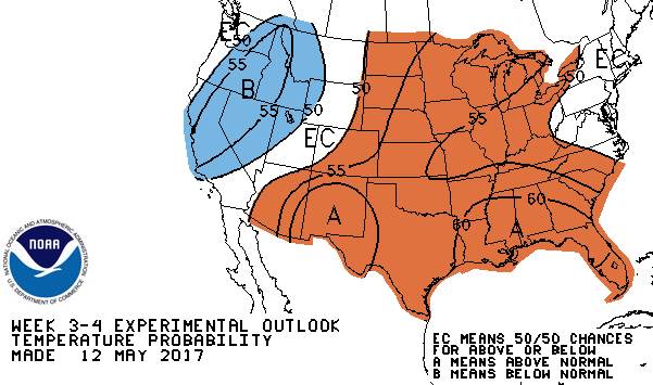
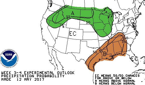
The general trend will be for well above normal temperatures through the next week. Expect the very warm temperature to be followed by a cooling trend to start around May 25 bringing temperatures down to slightly below normal by the end of the month. Then expect temperature to warm again to above normal levels for much of June. Expect precipitation on average to be near normal from now through the end of June.
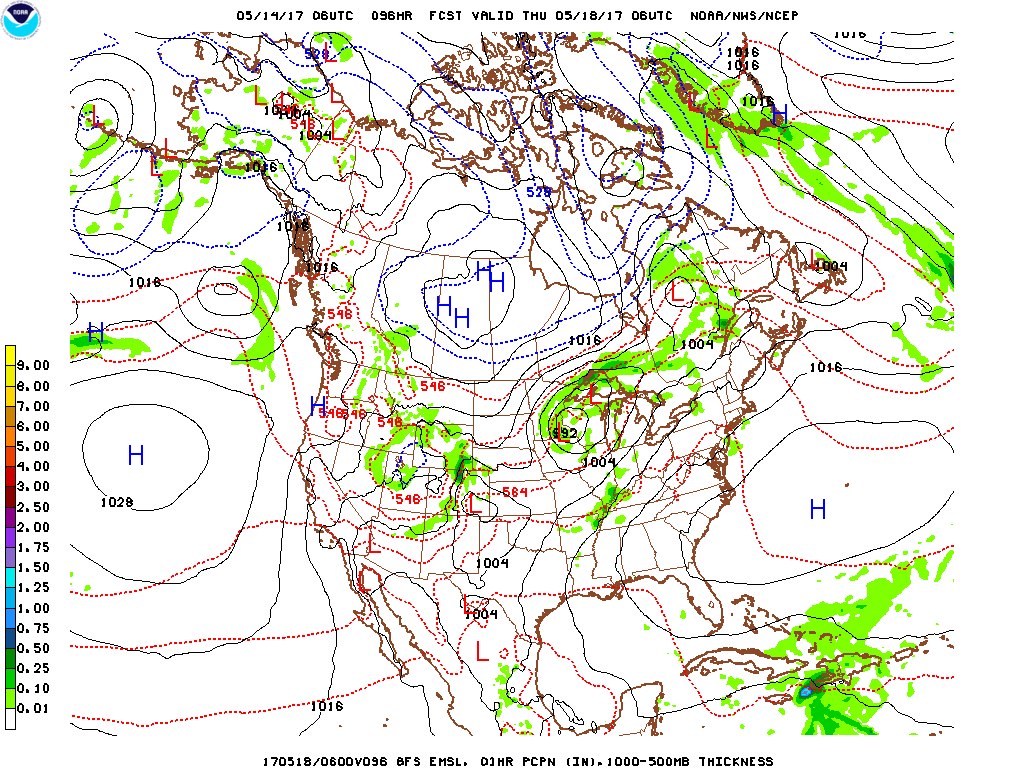
Forecast discussion day 3 – 5 (17 May – 19 May) Temperatures above normal; widely scattered rain showers possible mid to late in the period. A large warm high pressure system will slowly move east of the forecast region allowing a southwest wind flow to dominate the eastern US during this period. This will push temperatures well above normal with only widely scattered showers mid to late in the period but mostly dry conditions for most locations through the period. Expect high temperatures to range from the mid 80s to mid 90s. Low temperatures ranging from the mid 60s to low 70s. Precipitation amounts will likely be in the 0.00 – 0.05” range.
Climatology:
| Station | High T | Low T | Station | High T | Low T | |
| Charlottesville VA | 78 | 55 | Greensboro NC | 80 | 58 | |
| Richmond VA | 79 | 55 | Asheville, NC | 77 | 54 | |
| Roanoke VA | 77 | 54 | Charlotte, NC | 81 | 56 | |
| Hillsville VA | 74 | 50 | Fayetteville, NC | 82 | 55 | |
| Salisbury, MD | 75 | 54 | Aberdeen, MD | 75 | 54 |
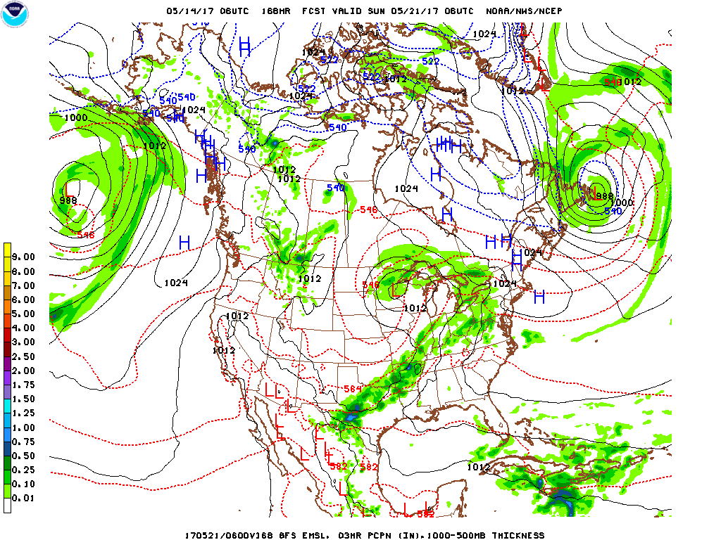
Forecast discussion day 6 – 8: (20 May – 22 May) Temperatures cool slightly but stay above normal; wide spread showers throughout the-period. The large warm high pressure system previously mentioned will slowly move well east of the region allowing a cold front to slowly approach the region from the west. The temperatures will decrease several degrees as clouds and showers increases as the cold front approaches. Expect the period to see widespread showers and thunderstorms. Expect high temperatures to range from the mid 80s to low 90s.. Low temperatures ranging from the low 60s to upper 70s. Precipitation amounts will likely be in the 0.30 – 0.60” range.
Climatology:
| Station | High T | Low T | Station | High T | Low T | |
| Charlottesville VA | 80 | 58 | Greensboro NC | 81 | 59 | |
| Richmond VA | 81 | 57 | Asheville, NC | 79 | 56 | |
| Roanoke VA | 79 | 56 | Charlotte, NC | 83 | 58 | |
| Hillsville VA | 77 | 51 | Fayetteville, NC | 84 | 56 | |
| Salisbury, MD | 77 | 56 | Aberdeen, MD | 77 | 54 |
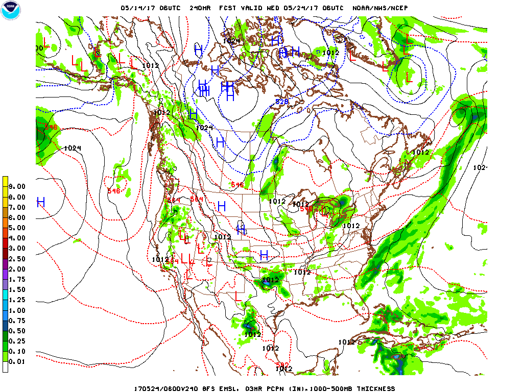
Forecast discussion day 9 – 11: (23 May – 25 May) Temperatures cool to near to normal; scattered showers and thunderstorms early, widespread late in the period. The previously mentioned cold front moves through the region early cooling temperature and bringing scattered rain showers and thunderstorms to the region. By late in the period expect as second cold front to moves through the region bringing widespread rain showers and thunderstorms and cooling the temperature in the forecast region to slightly below normal. Expect high temperatures to range from the mid 70s to low 80s. Low temperatures ranging from the low to upper 50s. Precipitation amounts will likely be in the 0.25 – 0.40” range.
Climatology:
| Station | High T | Low T | Station | High T | Low T | |
| Charlottesville VA | 80 | 58 | Greensboro NC | 81 | 59 | |
| Richmond VA | 81 | 57 | Asheville, NC | 79 | 56 | |
| Roanoke VA | 79 | 56 | Charlotte, NC | 83 | 58 | |
| Hillsville VA | 77 | 51 | Fayetteville, NC | 84 | 56 | |
| Salisbury, MD | 77 | 56 | Aberdeen, MD | 77 | 54 |
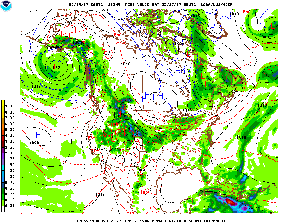
Forecast discussion day 12 – 14: (26 May – 28 May) Temperatures cool to slightly below normal; scattered showers all period. Expect a series of weak frontal systems to move through the forecast area through the period. This will keep temperatures slightly below normal and cause periods of rain showers throughout the period. Expect high temperatures to range from the low 70s to low 80s. Low temperatures ranging from the upper 40s to mid 50s. Precipitation amounts will likely be in the 0.20 – 0.40” range.
Climatology:
| Station | High T | Low T | Station | High T | Low T | |
| Charlottesville VA | 81 | 59 | Greensboro NC | 82 | 60 | |
| Richmond VA | 82 | 58 | Asheville, NC | 80 | 57 | |
| Roanoke VA | 80 | 57 | Charlotte, NC | 84 | 59 | |
| Hillsville VA | 78 | 52 | Fayetteville, NC | 85 | 57 | |
| Salisbury, MD | 78 | 57 | Aberdeen, MD | 78 | 55 |
Day 15 – 30 Temperature Outlook 29May – 13 Jun
Day 15 – 30 Precipitation Outlook 29May – 13 Jun
| Outlook discussion day 15 – 22: (29 May – 05 Jun) Early indications are that temperatures and precipitation will be near the seasonal average during this period. |
Outlook discussion day 23 – 30: (06 Jun – 13 Jun) Early indications are that temperatures be above the seasonal average during this period with precipitation near normal.
|
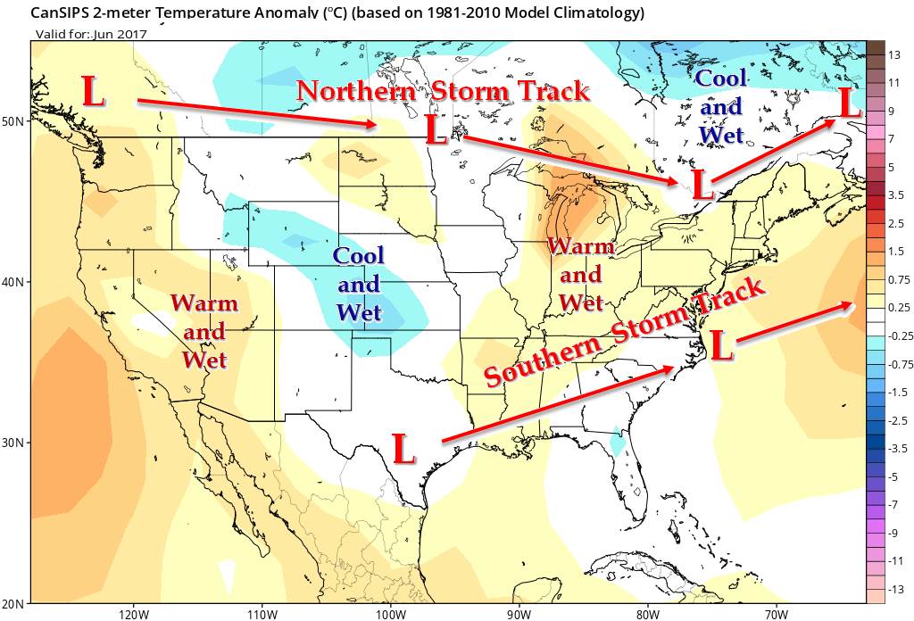
| June Outlook 2017 | |
| Expect the forecast region to be generally warmer than normal during June. The expected position and activity along the southern storm track will promote warm and moist southerly flow into the Southeast US and Mid-Atlantic states during the period with near normal precipitation. |


