General Weather Discussion
A broad upper level low pressure trough will continue across the Eastern 1/2 of the USA into the weekend.Multiple weaker disturbances and associated frontal boundaries will move through this upper-level trough from both the NW and W/SW over the next couple days. This makes timing of clouds and winds a little more difficult than even normal, particularly from North Carolina through the Mid-Atlantic. The next strongest disturbance and associated frontal boundary will move through the area late Tuesday night through early Wednesday afternoon. Gusty south winds of 10-20 ahead of front, turning to West then NW behind the front later Wednesday into early Wednesday evening. Not a lot of rain is expected with this system, but local totals of 1/4 inch or more, mainly the Mid-Atlantic Region.
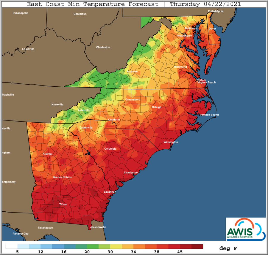
Frost and freeze potential Thursday morning greatest across the Southern Appalachians and foothills, with frost into the Piedmont areas of Northern South Carolina into Central North Carolina. Areas further to the Northeast and closer to the Atlantic may have more clouds and wind to help limit frost and/or freezing temperatures.
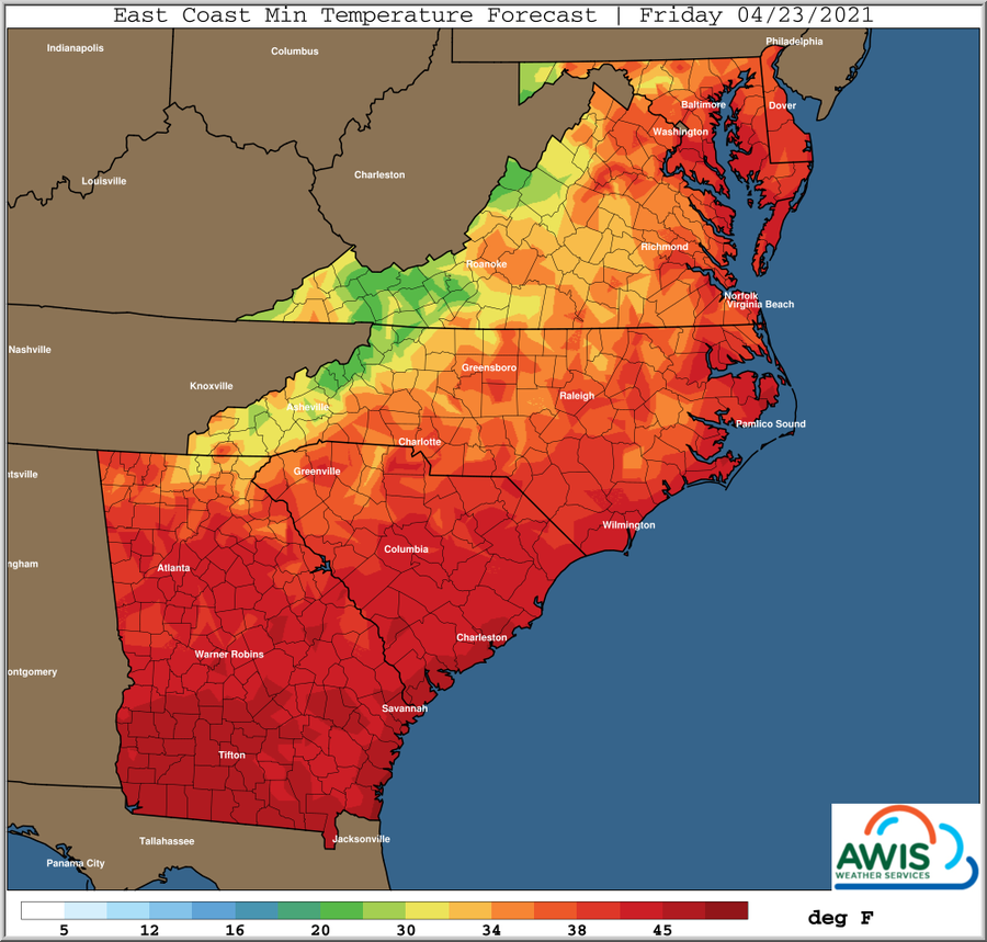
Larger areas from the Northern Interior Southeast to the Interior Mid Atlantic will have frost and/or freeze risks on Friday morning. Winds will be lighter most areas Friday morning, allowing radiational conditions to take hold with ground temperatures 3-6 degrees colder in some areas than temperatures normally taken at the 5-foot levels. Clouds will also be less prevalent many areas later Thursday night through sunrise Friday morning.