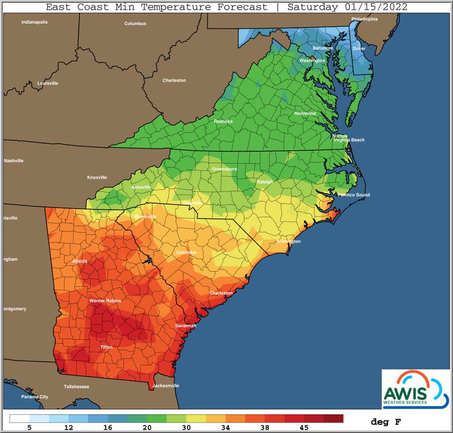
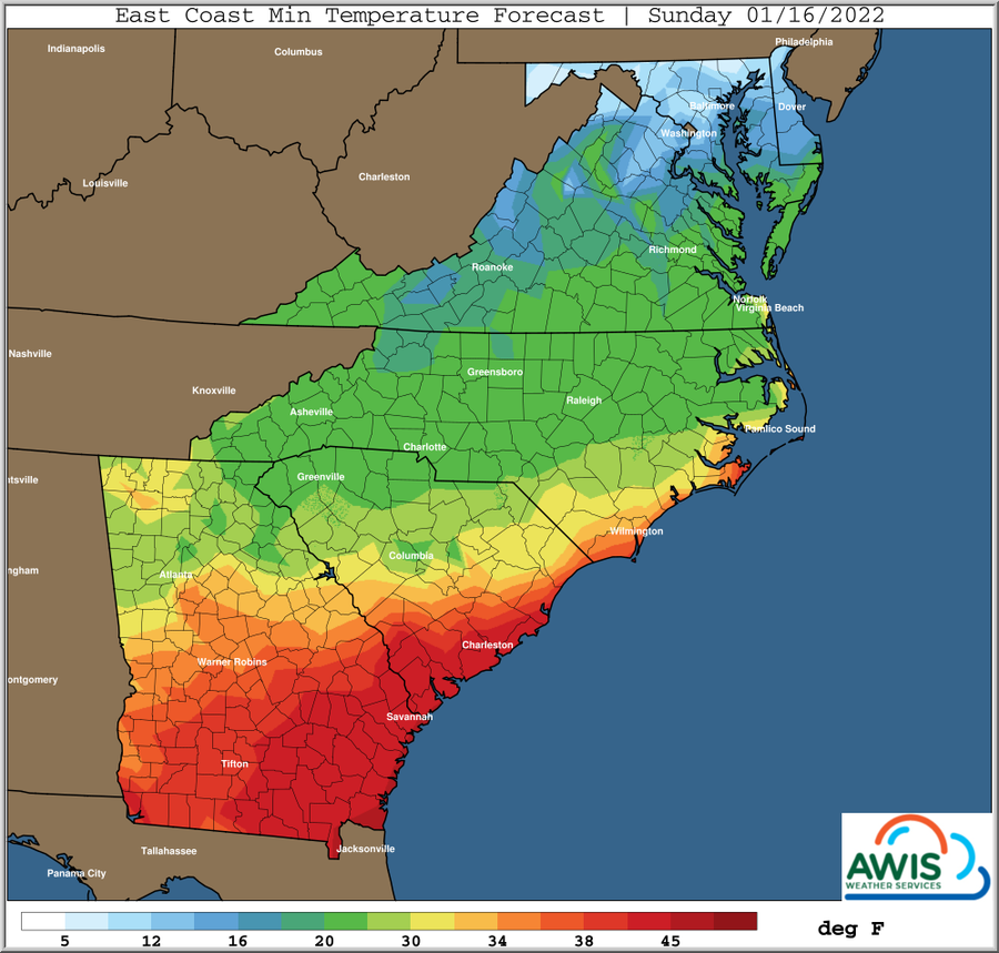
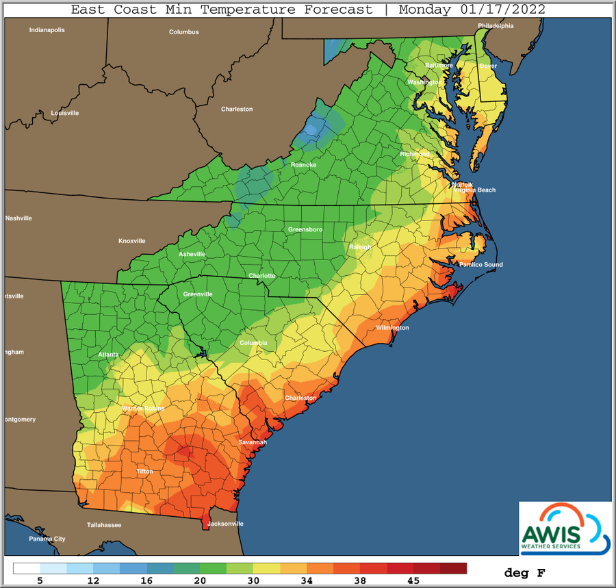
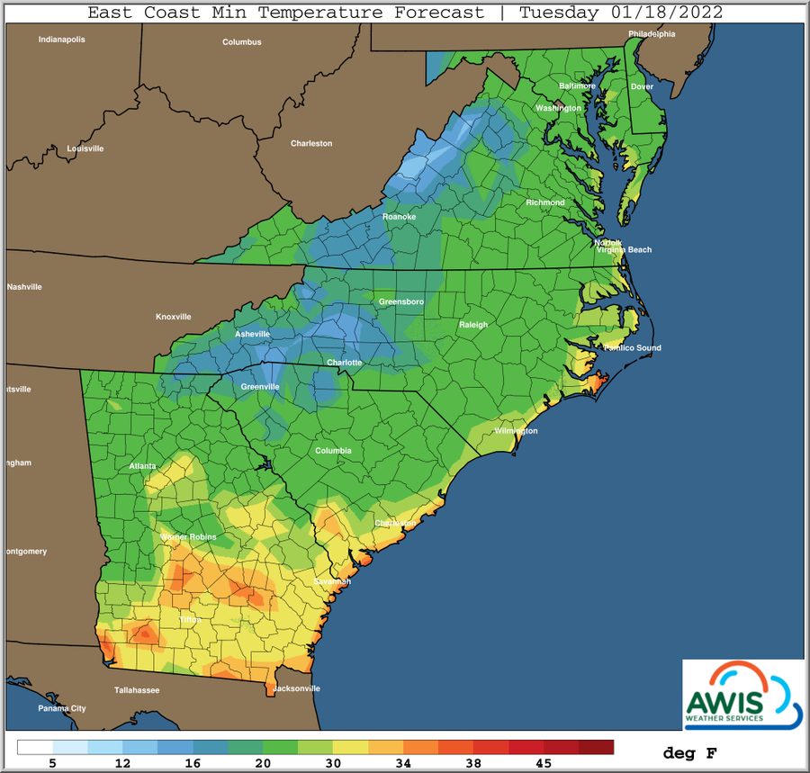
AWIS Weather Advisory: Snow, Wind and Cold Temperatures ahead
Dear all,
the upcoming weather can be a dangerous situation in some areas, especially in those that will experience snow cover. We face some warmer temperature and snow over the weekend, followed by cold temperatures that will require row-cover use. Additionally, we will see some higher windspeeds tomorrow.
IF YOU ARE A IN AN AREA THAT WILL EXPERIENCE TEMPERATURES in the 10s early next week, we recommend to protect your plants with row covers before the snow and rain moves in.
General Weather Discussion:
*** Cold Shot Mid-Atlantic This Weekend *** More Wintry Weather Mid-Atlantic, Western Carolinas Late This Weekend *** Much Colder Again Late Next Week, Particularly NC Into Mid-Atlantic *** Periods of Cold Intrusions Continue Into Late JanuaryLow pressure will move through the Western Atlantic near Bermuda
and then North/NW into extreme Eastern Canada into this weekend.
Behind this colder air will move into the NE USA and funnel down
the backbone of the Appalachians into the Mid-Atlantic and Northern
areas of the SE States.
This will likely bring yet another hard freeze into mainly Interior
Mid-Atlantic this weekend, particularly Sunday morning. Some middle
teens possible Northern areas as light winds and low dew points
will linger in this area, and clouds will be slow to increase until
closer to dawn.
Further South, minimums will be mostly in the mid-upper 20s or
warmer into Southern VA and points South as clouds increase and
precipitation begins to fall ahead of the next winter system late
this weekend.
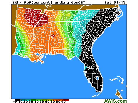
This next system is very dynamic, and will tap into some Gulf and
Atlantic moisture as it moves NE from the deep South Saturday through
Eastern VA late Sunday. Thus precipitation amounts will be on the
moderate-heavy side.
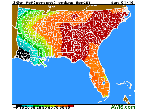
With cold air in place over the Mid-Atlantic and Western Carolinas,
expect wintry precipitation to spread into these regions late
Saturday night from the West/Southwest, overspreading all areas
on Sunday.
Potential for a significant snow event in the Central and Southern
Appalachian mountains, perhaps even into the foothill areas
as well and Interior VA, with a mixed bag of wintry precipitation
on the fringes just to the East and South of this region. Mostly
rain is expected as you get closer to the Atlantic Coast in the
Carolinas and SE VA and for the Eastern and Southern 2/3rds Georgia.
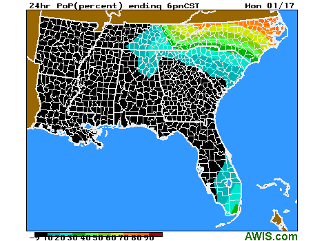
Colder again behind this system for Tuesday morning as surface high
pressure settles over the region. Minimums will not likely be any
colder than what has already occurred recently, but will vary
depending on snow cover depth.
Warming up for the middle of next week, then the next cold front
moves through next Thursday, with light precipitation ahead of that.
For now no major wintry precipitation is expected with this frontal
passage.
However, it will turn much colder again late next week with hard
freezes again, particularly Northern SC and points Northward.
This will be next Friday and Saturday mornings, with perhaps
next Saturday morning being the coldest with the lightest winds
anticipated.